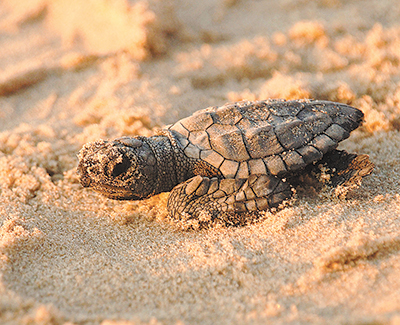
Noosa Shire Council has introduced a new mapping tool to help protect the region’s turtles.
Noosa’s beach cleaning contractors will soon be issued with new Global Positioning System (GPS) mapping technology to help them steer clear of turtle nests on the eastern beaches.
The new technology will better protect the turtles and their nests during daily beach combing activities.
Contractors access the mapping tool using dash-mounted iOS, Android or Windows tablets.
The app alerts the drivers to nest locations.
“A lot of the time beach cleaning takes place before the sun is up,” explained Technical Officer Craig Smit.
“This new mapping tool means the contractor can navigate around the nests using GPS, rather than trying to work out their locations from a handwritten or printed list.”
Wildlife volunteers document the turtle nest locations and submit the details to Council using handheld GPS devices.
Council staff members then add this information to the digital mapping system used by the cleaning contractors.
“It is easy to implement and it’s helping protect turtles and their nests, which are often hidden in the dunes,” Mr Smit said.
He said injury to turtles on the beach due to beach combing was uncommon, but the new technology promised to minimise the risk further and provide the contractors peace of mind.
“The beach cleaners have been using the GPS maps for a short time and the feedback has been good,” Mr Smit said.