In 2007 Liverpool Plains Shire Council (LPSC) developed the Tr@ceR Weeds Mobile Mapping Program.
Developed in-house by IT and Weeds Inspectors, Tr@ceR Weeds Mobile Mapping was integrated with Council’s property data and Google Earth, enabling staff to pinpoint location and mapping of weed infestations.
The program captures data on the type of weed, infestation size and geographic infestation trends, enabling inspectors to pinpoint areas with a potential risk to the environment, and identify where containment and remediation action is required.
The latest version of the Tr@ceR Mobile Mapping program allows inspectors to use Apple® iPhone, iPad or Windows® phone technology to capture weed infestations, which includes the ‘track your path’ functionality. Using an iPhone or iPad in the field gives the inspector more freedom to move around, particularly when inspecting in rugged terrain or on the water when inspecting for aquatic weeds.
The data collected in the field easily imports into Tr@ceR, where the user can then click on the points captured to get landowner and property information, allowing the generation of inspection documents, or integration with the council’s current work templates.
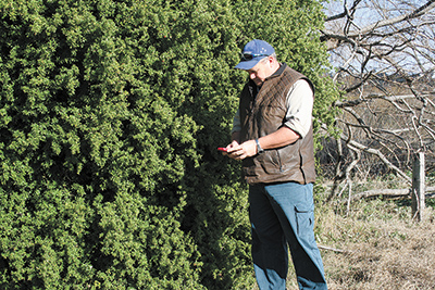
Jamie Dixon-Keay Vegetation Management Officer, Bega Valley Shire Council
Jamie said, “Hearing through contacts the amount of councils that were taking up this program made us think this was the way to go. The ease of use combined with the ability to structure the program to our own specific needs, allowed us to accurately map weed infestations.
“The staff at Liverpool Plains Shire Council (and the implementation of the program) were second to none they had the ability to answer questions on all facets of the program and help with the installation and training.
“The product, compared to other systems, has ease of use and program backup has to be an outstanding factor. The program is built by weed inspectors for weed inspectors. Other programs were not specific to our line of work, which meant we found them difficult and cumbersome.
“Tr@ceR has met our expectations and exceeded them! Our inspection numbers have more than doubled since we have had the program up and running. Mapping and GPS has made fieldwork extremely efficient.
“Correlating information for reporting has never been easier and delivery of information to the customer/landholder has improved relations. It’s an outstanding program with the ability to move forward with future requirements.” Jamie concluded.
Brett Jones Chief Weeds Officer, Cooma-Monaro Shire Council
“Cooma-Monaro Shire Council is in the process of adopting Tr@ceR Mobile Mapping to map and record noxious weed infestations throughout the Shire.
The purchase is deemed necessary as our existing weed mapping software has been superseded and no longer receives technical support. We first looked into Tr@ceR Mobile Mapping at the 2011 NSW Weeds Conference and more recently during a visit to Bega Valley Shire Council where staff have been very pleased with its simplicity and functionality.
Tr@ceR is compatible with Council’s existing computing systems and from all accounts appears to be very user friendly whilst meeting our weed mapping and reporting needs.” Brett said.
Colin Groves Chief Weeds Officer, Bombala Council
“Bombala Council’s weed mapping system has been made obsolete and Council has also changed its overall system to Authority. The Authority program for weed mapping did not work effectively and the Tr@ceR system was mentioned to the Bombala Council by Bega Council, who said that the system works quite well with the Authority program, so we approached Liverpool Plains Shire Council for a presentation.
“Working with the Authority system and its functionality of easy workable usage for weed mapping and reporting was an important factor for its purchase.” Colin said
Liverpool Plains Shire Council (LPSC) has also entered the Queensland Local Government market with sales of the program to two of the largest regional councils in Queensland, Gympie and Sunshine Regional Councils.
LPSC now has 16 Local Government and two State Government sites in New South Wales and Queensland using its mobile mapping program.
For more information please contact Mike Urquhart or Mark Daly on (02) 6746 1755.
*Copy supplied by LPSC.
For more information visit: www.lpsc.nsw.gov.au