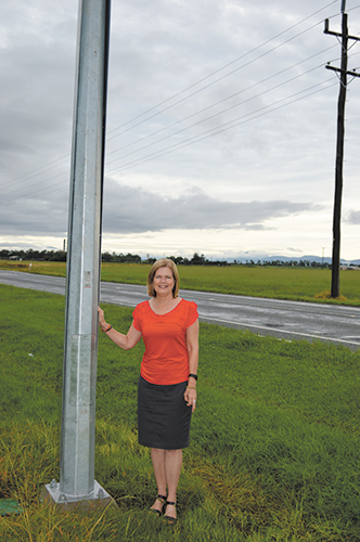
The installation of a new camera system on Shute Harbour Road will provide timely flood information to residents of the Whitsunday region.
Mayor of the Whitsunday Regional Council, Jenny Whitney said the installation of the new flood camera would allow members of the community to view up-to-date footage of the road on Council’s website.
“Hamilton Plains regularly floods during the wet season and heavy rain events, and this particular section of the road has the ability to change very quickly and prevent residents from accessing their homes, workplaces, schools and the Whitsunday Coast Airport.
“The new flood camera displays images at locations where peak flooding tends to occur, both north to Airlie Beach and south to Proserpine.
“The images are updated approximately every 15 minutes during daylight hours and the date and time is displayed at the bottom of each image.”
Mayor Whitney reiterated that any flooded road can be deadly and urged people to be sensible when travelling in severe weather.
“Flood waters are dangerous for all vehicles, no matter what size.
“Once you enter flood waters, you give up control of your vehicle and there is no way of telling how strong the current is or the condition of the road.
“When considering your journey it’s important to have a Plan B and equip yourself with multiple alternatives to stay safe; our flood cameras can now assist with that.”
The Hamilton Plains Flood Camera Project is an initiative fully funded by the Whitsunday Regional Council in cooperation with the Department of Transport and Main Roads.