Home » Citizen scientists train their mobiles on coastline

Citizen scientists train their mobiles on coastline

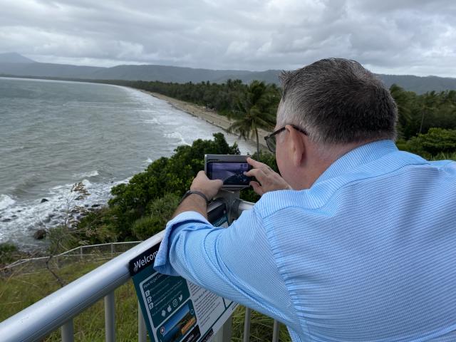
A COMMUNITY beach monitoring project will help scientists better understand and forecast how coastlines will change at five popular beaches in Douglas Shire in Queensland.

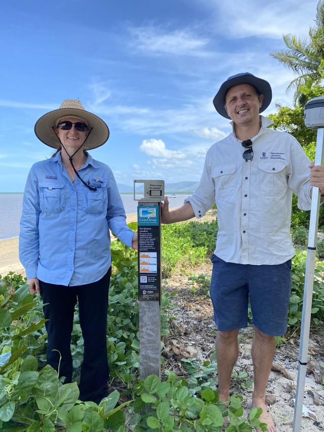
Coast Snap encourages residents and visitors to participate by taking photos of precise locations and sharing the photo online.

Mobile phone cradles are now available at Four Mile, Cooya Beach, Newell Beach, Wonga Beach and Cow Bay.

Over time, the database of photos will record erosion and recovery cycles, helping Douglas Shire Council understand why some beaches are more dynamic or resilient than others.

University of NSW Senior Lecturer Dr Mitchell Harvey, who is a coastal erosion expert, visited the five beaches this week. He said the program would help scientists manage coastlines around the world. “CoastSnap is a global community beach monitoring project that turns your smartphone in your pocket into a powerful device to measure how our coastlines change over time,” he said.

“It uses the power of social media and all you need to do is put your smartphone in one of our cradles, take a photo and upload it to the cloud.

“We have actually developed some really powerful algorithms to precisely track how the coastline is changing. “

Using a specialised technique known as photogrammetry, CoastSnap relies on repeat photos at the same location to track how the coast is changing over time due to processes such as storms, rising sea levels, human activities, and other factors.

The images are pinpointed to ensure the photos have similar accuracy to professional coastal survey teams.

Douglas Shire Mayor Michael Kerr said if everyone to got involved they could build a strong database of images.

“The more photos we collect at a particular site, the more reliable our understanding of how that coastline is changing over time,” he said.

“Monitoring these changes is important so that the impacts of coastal hazards can be avoided, mitigated or managed through adaptation planning.”

The development of a photo monitoring program delivers on the priority actions, as identified in Council’s Resilient Coast Strategic Plan 2019-2029, as part of the Coastal Hazard Adaptation Strategy. Each photo monitoring point has instructional signage on how to use the phone cradle and photo uploading options.

Digital Editions


  • Lismore four years on

    Lismore four years on

    Four years on: How Lismore is building back and setting a national benchmark. When the 2022 flood inundated Lismore, it was not simply another extreme…

More News

  • New-look reserve reopens

    New-look reserve reopens

    Toongabbie’s Sue Savage Reserve has reopened after a $4 million upgrade featuring a new skate park, BMX pump track, fitness equipment, an amenity building, park furniture, drainage upgrade, landscaping and…

  • Temora address housing shortage in tiny hamlet

    Temora address housing shortage in tiny hamlet

    Proposed Ariah Park Village Subdivision to Address Housing Shortage – Lots from $90-000 to $110,000 in the small picturesque hamlet. Temora Shire Council is investigating the delivery of a proposed…

  • Douglas Shire seeks renewal

    Douglas Shire seeks renewal

    Creative store opens in Mossman through empty spaces program. A new store and community art space has opened in Mossman thanks to a program designed to breathe new life into…

  • New youth and community centre for McLeay

    New youth and community centre for McLeay

    A new Youth and Community Centre planned for Macleay Island will service the needs of the growing community and will also be designed so it can support community recovery following…

  • Grants close soon

    Grants close soon

    Queensland councils have until 31 March to apply for Round two of the State Government’s Secure Communities Partnership Program, which offers up to $400,000 per project for CCTV, lighting and…

  • Sod turned on major upgrade at Paul Fitzsimons Oval

    Sod turned on major upgrade at Paul Fitzsimons Oval

    Work has officially begun on the redevelopment of Paul Fitzsimons Oval with Alice Springs Town Council and the Australian Government turning the first sod this morning. Mayor Asta Hill and…

  • Lockyer send flood expert north

    Lockyer send flood expert north

    Lockyer Valley Regional Council has answered the call for assistance from a community impacted by Ex-Tropical Cyclone Koji, with a staff member from Council’s Disaster Management Unit deployed to support…

  • From books to bots

    From books to bots

    Tenterfield Library is proving that technology is more than just tools and devices. From coding and robotics to tech support, the Library has become a place where curiosity, connection and…

  • Major repairs for levee

    Major repairs for levee

    Goondiwindi Regional Council has endorsed its largest-ever capital works project to repair and reinforce critical sections of the Goondiwindi levee, following significant erosion after recent floods. At this week’s Ordinary…

  • Stretching for a good cause

    Stretching for a good cause

    Ballarat residents stretched, smiled and snuggled their way through a unique Kitten Yoga event that combined relaxation with a heartwarming cause – helping kittens find their forever homes. Hosted by…