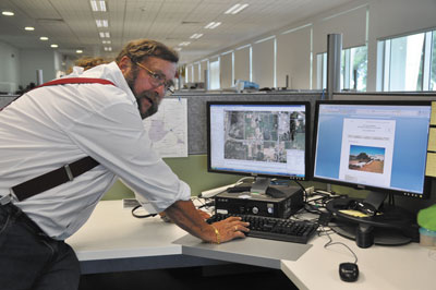
The City of Cockburn’s Geographical Information Systems (GIS) team has developed a new program that allows people to view photos and information dating from the 1950s until 2010.
The ‘aerial historical’ program provides useful information for people interested in local history or wanting to know about a particular property. It is housed on the public Intramaps System and accessed via Council’s website.
Cockburn Mayor Logan Howlett said it was an excellent tool for the public.
“This new program is useful for those interested in local heritage, and for developers to see if there are any constraints or heritage listings on the land before purchasing it or lodging a planning application.
“Using an aerial slider, people can slide back and forth between photos to see gradual changes in land uses over time on their own property or area of interest. It is very user-friendly and any member of the public can view it.”
The program also locates and explains places of historical significance, such as Aboriginal sites.
Cockburn is one of the only councils in Western Australia to offer this aerial historical program to the wider community.
“The City is very fortunate to have the expertise of our GIS staff. People in the community now have more access to information than ever before,” Mayor Howlett said.
To access this module from the City’s website visit www.cockburn.wa.gov.au and click on ‘aerial historical’ under the module section on the left hand side.